The trip planner that goes where the signal dies.
Plan smarter, travel safer, come home with skills worth keeping. One app for paddling, hiking, camping, hunting, fishing, cycling, climbing, and winter trips — offline satellite maps, live weather, USGS river gauges, elevation profiles, and an AI Coach that knows your route. Built for people who actually go.

Join CWS. Upgrade when you’re ready.
- Join THE CAMPFIRE.Enter Skool and start with the community and free lessons.
- Explore the system.Open the Classroom, choose Hiker, Paddler, or Hunter, and try the free lessons.
- See the full library inside Skool.When you want the full library, Field Manual, app, and weekly call, pricing and billing are handled there.
In short: CWS is a trip-planning tool for every outdoor activity — paddling, hiking, camping, hunting, fishing, cycling, climbing, and winter travel. A guided intake builds a plan around your actual skill gaps for whatever you're doing, then backs it with offline satellite maps, weather refreshed every 15 minutes, live USGS river gauges, elevation profiles, and GPS tracking with an emergency-contact check-in. A paid membership adds the AI Coach, unlimited trips, course completion certificates, and offline downloads for any region. It comes with a paid membership and runs in the browser on any phone, iPhone or Android, or as the Android app from Google Play.
What makes it different
A plan built for you, not a generic checklist
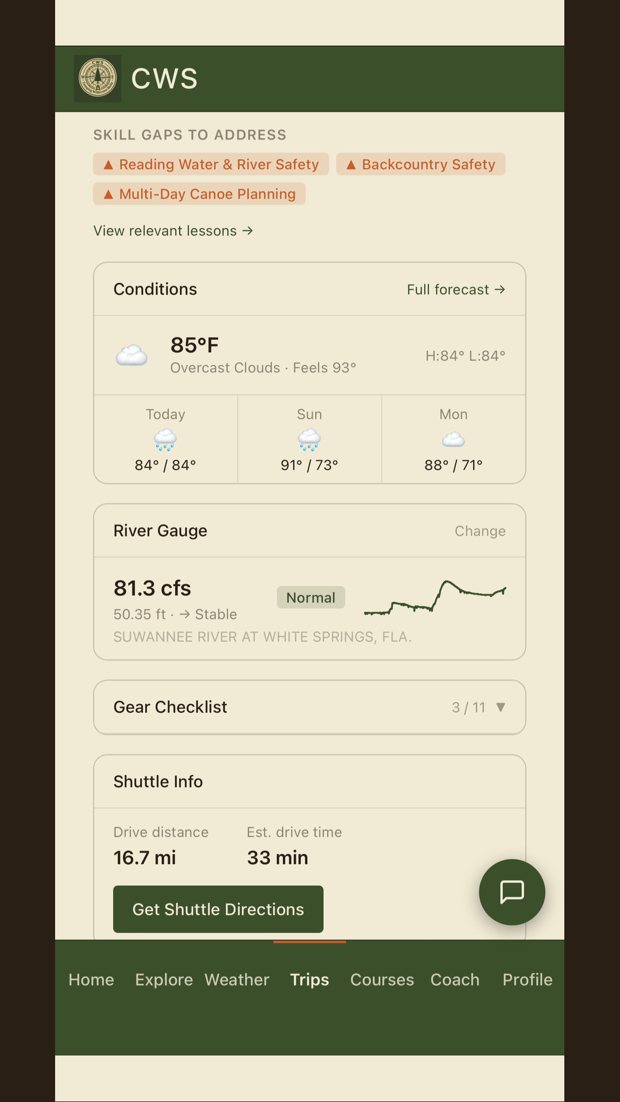
Answer a guided set of questions about your route, group, gear, and experience, and CWS builds a personalized trip plan that flags your actual skill gaps before they become emergencies. Weather, water level, gear, and shuttle logistics, all in one place.

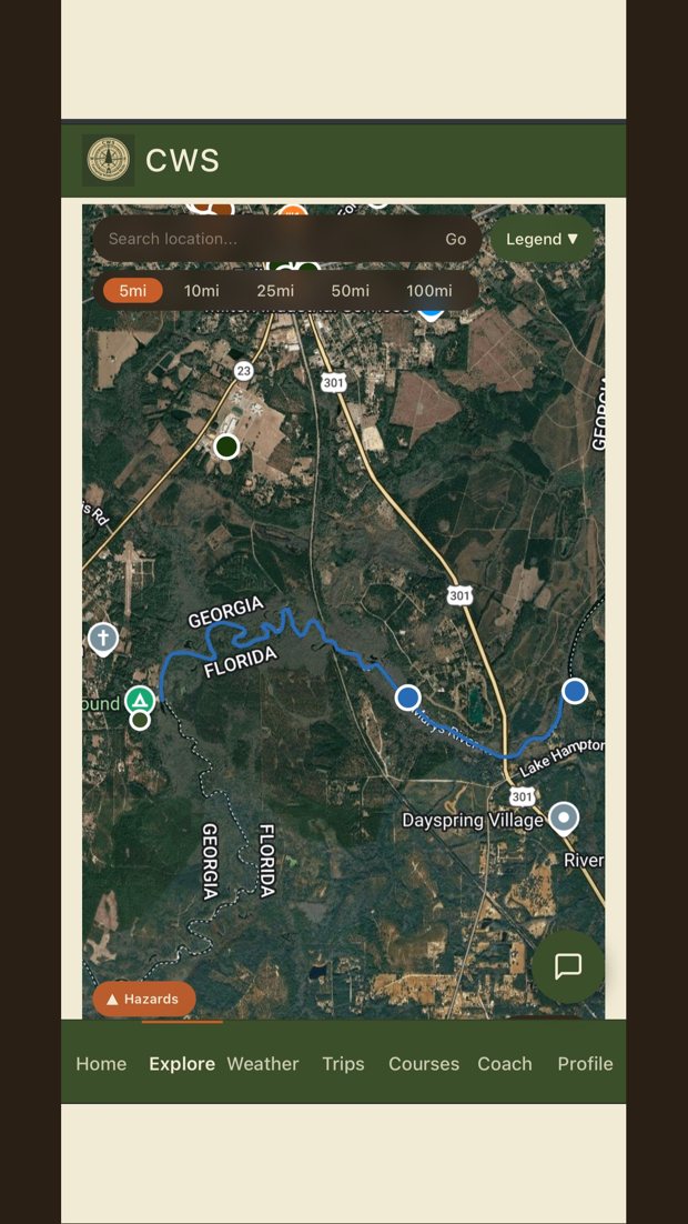
Satellite maps and GPS tracking that work offline
Download satellite and topographic maps before you leave the driveway, then track your route with waypoints and a live location dot, even with no cell service. Hazards and put-in/take-out points right on the map.

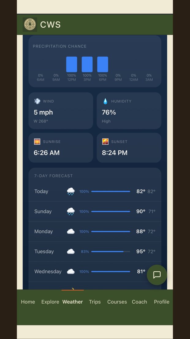
Weather every 15 minutes and live river gauges
Forecasts refreshed every 15 minutes for your exact coordinates, plus live USGS streamflow and gauge data so paddlers know the water level before launch day. This is the data that decides whether you go.

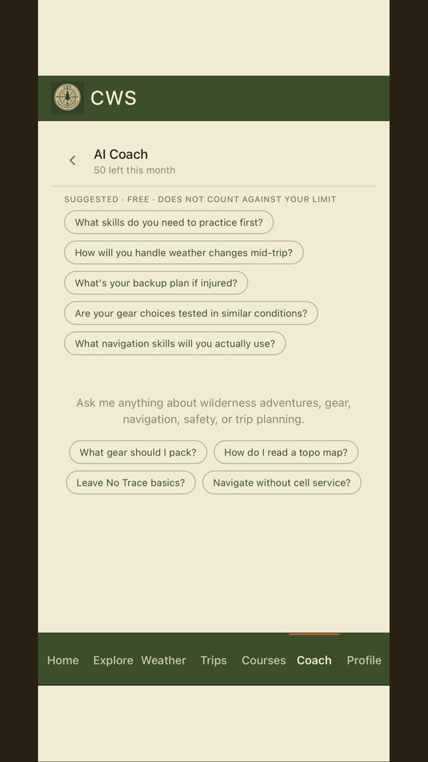
The AI Coach, the experienced friend in your pocket
A paid membership unlocks an outdoor assistant that knows your route, your trip history, and the current conditions at your destination. Ask it about gear, water crossings, navigation, or contingencies, and get answers built for your specific trip.

Nine activity types, each with its own plan
Paddling, hiking, camping, hunting, fishing, cycling, climbing, winter, or a hybrid trip that mixes them — CWS asks the right questions for what you're actually doing and builds a skill checklist specific to that activity, not a generic outdoor-trip form.

Elevation profiles, shuttle logistics, and a dark-sky map
See real elevation gain and loss for your route before you go, get shuttle drive distance and time between put-in and takeout, and switch to a night-lights basemap to find genuinely dark sky for stargazing — built from the same NASA imagery used to map light pollution worldwide.

What the Coach is not
It helps you plan. It does not make the call. It has not seen today’s water, it cannot hear the weather coming, and it will never know what your gut is telling you standing at the put-in. Check the gauge yourself. Leave a float plan with someone on shore. Turn back when the river says to. And if something goes wrong out there, it is not the thing you reach for. Call for help.
Everything in the app
Offline maps
Satellite and topo maps downloaded for anywhere you go.
GPS tracking
Route lines, waypoints, and a you-dot that works with no signal.
Live weather
Refreshed every 15 minutes for your exact route, with a full 6-day forecast.
USGS river gauges
Live streamflow (CFS), water level, and trend for paddlers.
Elevation profiles
Real gain/loss charts for your route, powered by USGS terrain data.
Skill-gap trip plans
Personalized planning for 9 activity types that knows what you still need to learn.
Shuttle logistics
Drive distance and time between put-in and takeout, one tap to directions.
Gear checklists
Built for your trip type, exportable to PDF.
GPX/KML export
Take your route data anywhere — import or export standard formats.
Hazards map
Known hazards layered directly on the map, not buried in a separate list.
Safety check-in
Location sharing and an "I'm back safe" tap for your emergency contact.
Trip Reflection
A guided post-trip debrief with an AI Coach that asks what actually happened out there.
Course certificates
Real completion certificates for finished modules and full courses.
AI Coach (paid)
Advice for your specific route, gear, and conditions, before and after your trip.
Free vs paid
Free
- 1 free trip per month
- Maps, weather, and river gauges
- GPS tracking and safety check-in
Paid
- The AI Coach
- Unlimited saved trip plans
- Offline map downloads, any region
- PDF trip reports to share
- Plus the full course library and Field Manual
Privacy first: no ads, ever. Your location data is yours, and is never sold or shared with third parties.
How to get the app
The CWS app comes with your community membership, not a separate app-store subscription. Join THE CAMPFIRE and upgrade, and the full app unlocks for you in the browser on any device, iPhone, Android or computer, or in the Android app from Google Play.
Join THE CAMPFIRE to get the appFree to install. The full app unlocks with a Camping Wilderness Skills membership, or by subscription in the app at $9.99 a month or $89.99 a year.
App questions, answered
Can I rely on the AI Coach for safety decisions?
No. It helps you plan before you go. It has not seen today's water and it does not know your crew. Check the gauge yourself, leave a float plan, and make the go or no-go call with your own judgement. In an emergency, call for help, not the app.
What is the CWS app?
A trip-planning tool for paddling, hiking, camping, hunting, fishing, cycling, climbing, and winter travel. A guided intake builds a plan around your actual skill gaps, then backs it with offline satellite maps, weather refreshed every 15 minutes, live USGS river gauges, elevation profiles, and GPS tracking that works when the signal dies.
Does it work for more than hiking and paddling?
Yes — nine activity types total: paddling, hiking, camping, hunting, fishing, cycling, climbing, winter, and hybrid trips that mix activities. Each one gets its own guided intake and skill checklist, not a one-size-fits-all form.
How do I get it?
It's included with your CWS membership. Join THE CAMPFIRE to get started, and the full app unlocks with a paid membership. It opens right in your browser with nothing to install, or you can get the Android app from Google Play. Either way there is no separate app-store subscription. Add it to your home screen and it works like any other app.
Does it work offline?
Yes. Maps download for offline use and GPS tracking works without cell service.
Does it have river gauge data?
Yes. It pulls live USGS streamflow (in CFS) and gauge trend data so paddlers can check levels before launch day, plus elevation profiles so you know the terrain before you go.
What is the AI Coach?
An outdoor assistant that knows your route, history, and current conditions, and answers questions built for your specific trip.
iPhone and Android?
Both. CWS runs in the browser on either, and the Android app is on Google Play with the iPhone app coming soon. No ads, and your location data is never sold.
Plan your next trip like you mean it.
One membership covers the full app, the course library and the Field Manual.
Join THE CAMPFIRENot ready to join yet?
Get the field notes. Water levels, what is running, and what we learned the hard way, a few times a month, straight from the river. No course, no pitch, and you can leave any time.